Are you tired of being that guy that spends hours on the water and hundreds of dollars in fishing gear and never catches a fish? Don’t worry, Backwater Fishing Hot Spots are easy to find if you know what you are looking for. Everyone starts out this way because you just don’t know what you don’t know.
I am going to help you by sharing my Top 5 Secrets to finding those fishing hot spots? Oh and the best part is you don’t even need a boat for backwater fishing. You can fish from the shoreline or hop into a fishing kayak or even a hybrid kayak SUP.
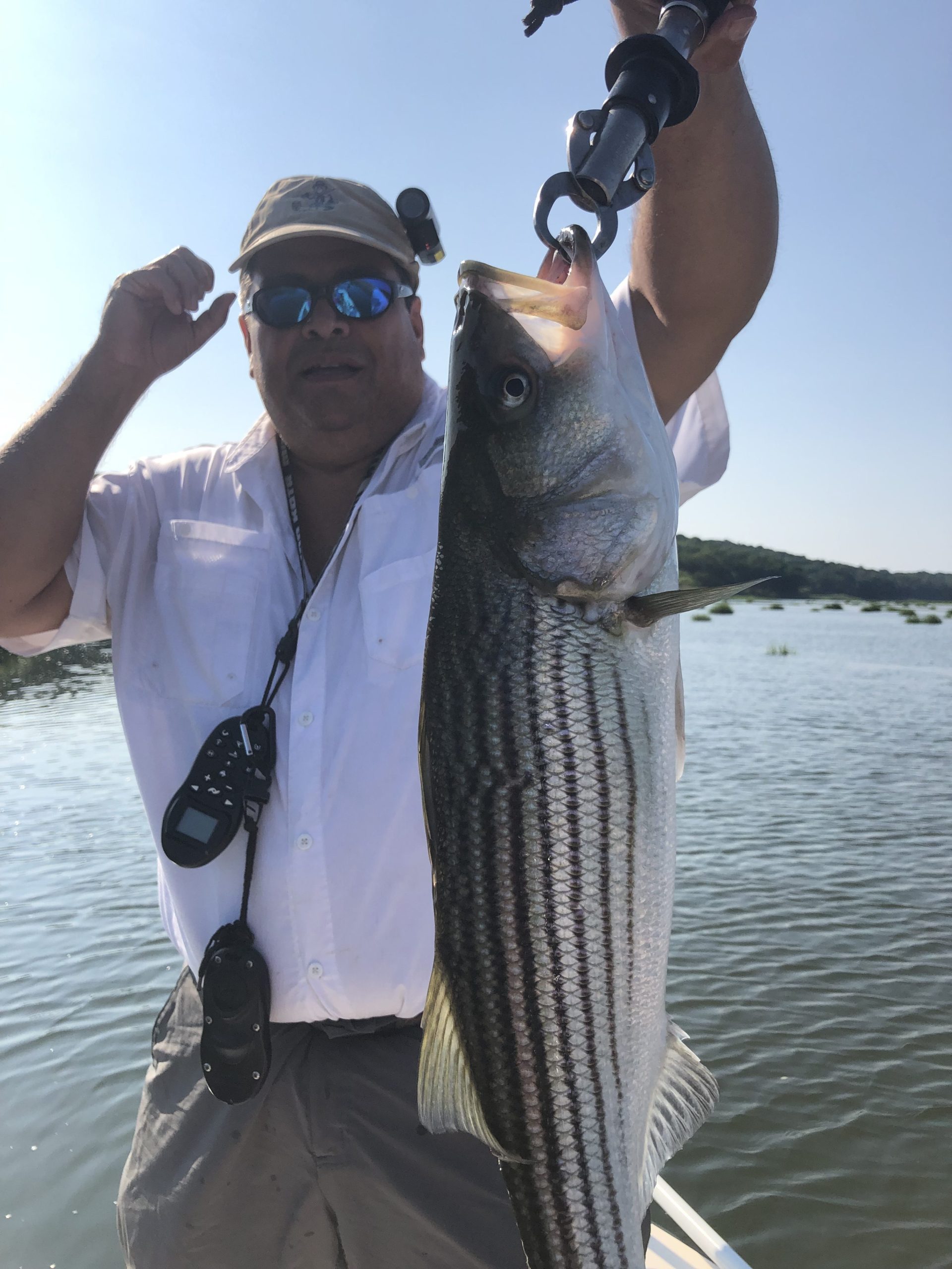
“Hey Man Where did you catch that Fish?”
I am asked this question all the time and people cannot believe my answer. I tell them it was in shallow, aka skinny backwater vs. somewhere far and deep.
Give A Person A Fish Or Teach Them How To Fish?
I imagine that Everybody wants to know your secret fishing spots, am I right?
I subscribe to the belief that it is better to teach a person how to fish vs giving them a fish.
Knowledge and Education are some of the most valuable things you can bestow on anyone. I share my Top 5 Secrets – on how I select my fishing spots and now you can use them to find your next favorite fishing locations.
How do I select a good skinny water fishing location?
So There are a few things you should do ahead of time to prep before you leave the dock or boat ramp try these 5 tips.
Finding a good skinny water fishing spot requires knowledge, experience, and an overall understanding of certain dynamics. Understanding the relationships between, the earth, moon, weather, season, time, water quality, bait, targeted fish and temperature are essential.
So, what do all the dynamics mean?
I will explain my 5 key tips to help you to discover the best locations, and increase your chances of hooking up with your prey.
Where should I Fish?…
Whether you fish Fresh or Saltwater you can use these tips for all bodies of water, shallow or deep, here we go.
Top 5 Secrets – Tip 1: Scout Your Locations
I believe scouting prospective fishing locations and research is most important to really know an area. Currents, storms and erosion always change the underwater terrain and landscape. This is especially true during the winter months, because shallow tidal waterways are ever changing.
I believe scouting trips during the early months of the fishing season are so important. In the Northeast where I live, the Winter months can get brutally cold and shallow waterways can freeze up and act like a bulldozer. The ice flows surge in and out with the passing tides, and change the underwater landscape. The sand and mud flats and channels are ever changing by this dynamic.

Depending on where you fish walk along the banks of the waterway. Try to do this at both low and high tides. You will discover and see the changes that occurred during the winter months. Visible are the cut grooves in the sand and mud that make up the channels cut by the currents. These grooves define the current’s flow and can be mapped.
The cuts and grooves define the underwater roadway for the fish. Low tide is very revealing, visible are rocks, and other structures, a normally hidden landscape. Look for obstacles, and ripples on the bottom where fish hide in wait ready to ambush prey swimming by.
Think like a fish hunting for food. Look for intersections where estuaries drain and intersect into larger bodies of water, as these cross roads are so productive.
Take note of the deeper channels during low water as they are the highway for the bigger fish. If you target and fish these deep channels and the adjacent area during a falling tide your odds of catching fish will increased. Bigger fish will travel the deeper cuts.
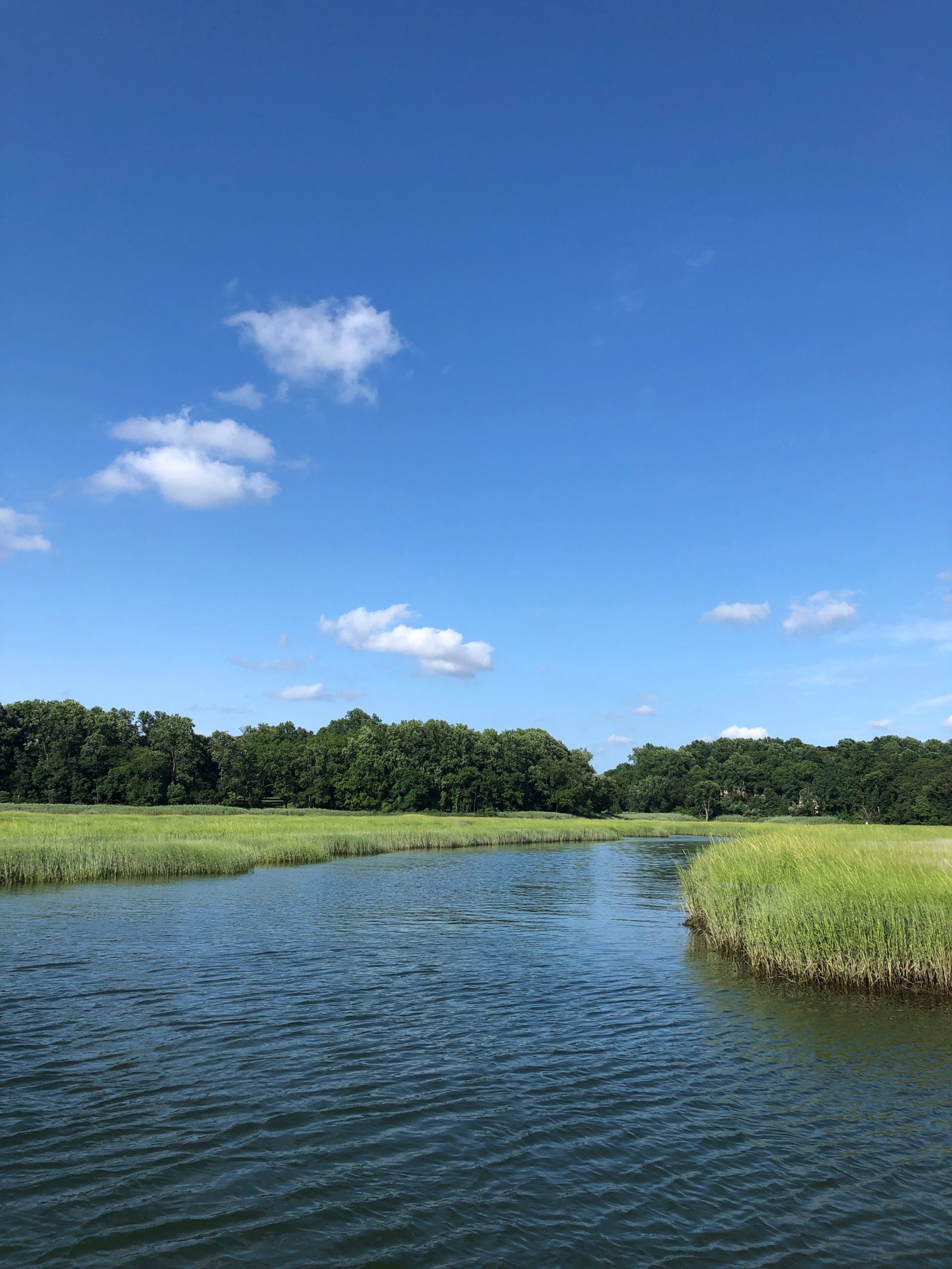
Top 5 Secrets – Tip 2: Fish the Tidal Estuaries and Backwaters
The backwaters and estuaries of harbors, tidal rivers and streams act like a nursery for the local predatory fish, as well as the baitfish. For smaller fish these backwaters provide a safe grass filled, nutrient rich environment where young predators and baitfish eat and hide from the larger predators. Remember where there is bait there are bigger fish hunting them.
Fish love to park themselves outside of the estuaries, tidal streams, and drains on outgoing tide. They lie in wait to ambush the baitfish as they get flushed out of the backwaters, like a mugger in a dark alley.
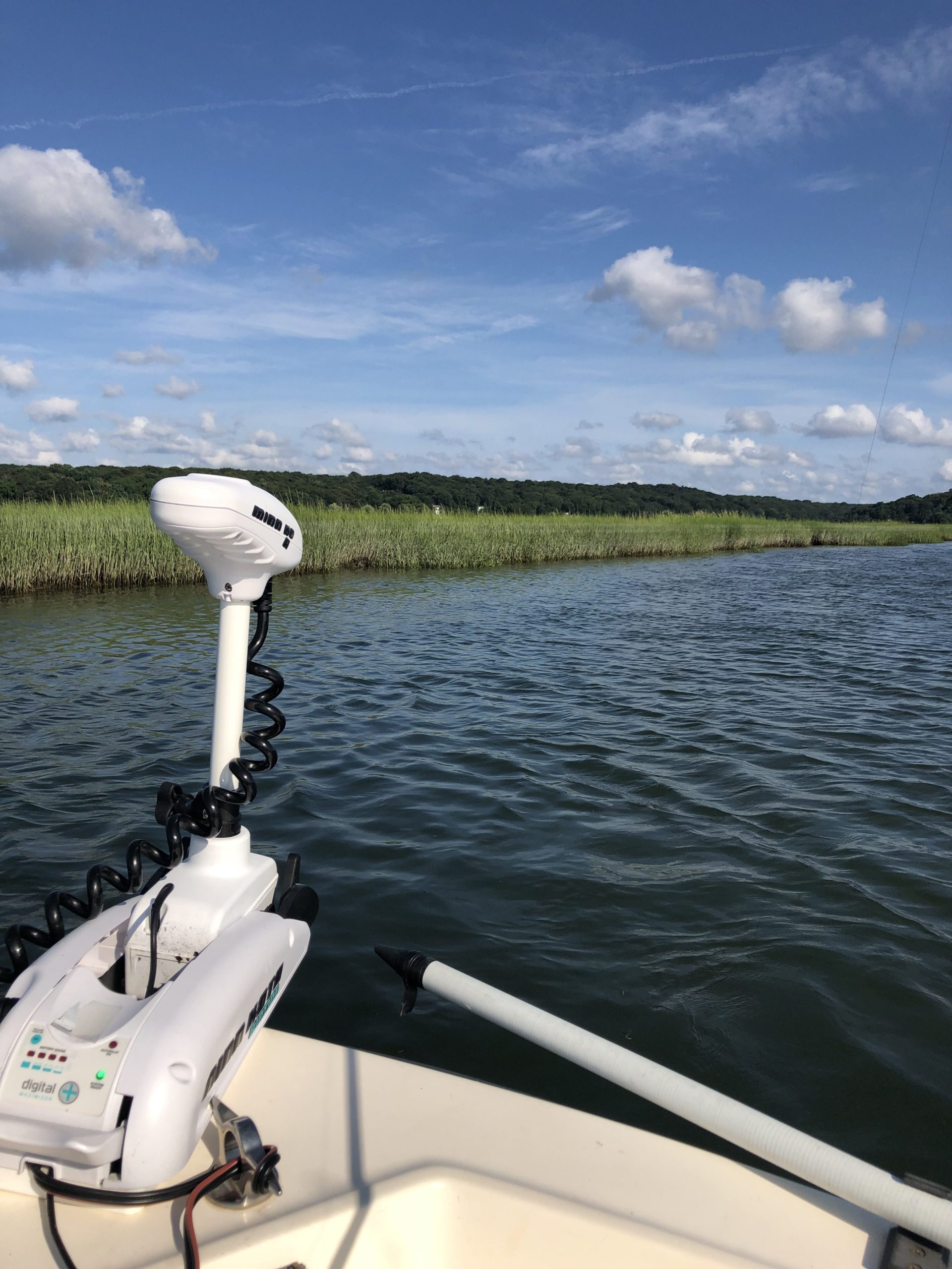
Minn Kota Trolling Motors insure my approach is super Silent

If you have a flats boats, skiff, kayak, canoe or even a paddle board, position yourself just outside of the estuary and cast your lure or bait towards the mouth of the estuary.
Make sure you don’t run over the sweet spot or you will spook the fish hunting this area. In order to be successful at fishing you need to be silent and stealthy.
I use Minn Kota Trolling motors they are great, as they provide great boat control and are very quiet.
Use On Line Fishing Maps…
Top 5 Secrets – Tip 3: Learn and Map The Under Water Drain Maze
The Estuaries and backwater are like giant water mazes.
The more you study an area at low tide the better you will understand the waterway paths when the water is high. When the water is high the deeper channels are invisible obviously because they are underwater. Just understand these fish pathways that cut through are still there. Study and map them mentally or sketch them out on maps.
Target fish that traverse these areas, and maintain your lures or bait offerings in or around these fish underwater roadways. Just like when hunting game on land, the woods are vast but the animals create game trails, find the trails… find the game.
Target and fish these areas just like you would when there is much less water. Understanding that fish are creatures of habit they will tend to be found traversing the same underwater roadways.
It is true that during high water fish will scatter and go everywhere basically chasing prey, but the bigger fish will keep to the deepest areas or be very close to them.
Bigger fish always want to be able to retreat back to the safety of the deeper water quickly. Fishing these areas just increases your odds of catching more, and bigger fish.
Top 5 Secrets – Tip 4: Today The Classroom is Online
As an avid fisherman and technology professional, I believe the internet is the best place learn anything.
A simple google search or now with the advent of AI the answer to all your questions is a click away. Chat GPT, Claude, Grok and more AI’s are available, Online courses have made the classroom less appealing as well as offer current and valuable skills at the click of your mouse.
It doesn’t matter what your topic or question is. Maybe you want to learn how to find your “Next Favorite Fishing Spot”, the best lure for catching Red Drum, knowledge is just a click away.
It is now very obvious that online courses tend to be packed with value and insights equal to and Many times better than a course taken in a classroom. depending on the topic the data can be fresher and more relevant to what you are seeking. And of course lets not forget (Immediate gratification) which is what the world demands today.
So, before I go out to fish a New Location I start with an internet search. Just like you found my blog here where I share my Top 5 Secrets, you can find anything. My Last Tip includes websites and an iPhone App I use when I research my Next Favorite Fishing Spot.
Top 5 Secrets – Tip 5. Web Tools and Apps I use:
I subscribe to many sites, leverage many tools, charts, and Apps on a Regular basis. The list I provide below are considered common sites, that you may have visited.
I love Google Maps and Google Earth. Like with any map, chart or satellite image we all look, but what we see may be very different from one person to another.
I believe Satellite images are just amazing, and I use them all the time to get a hyper accurate view of where I am, have been, or where I am planning on going. I study the area in detail
Today I use drones to fly over different area’s to get a vivid understanding of a water ways. My view helps me gain an understanding of the underwater landscape.
The drone camera I use is outfitted with Polarized lenses. Just like a good pair of fishing sunglasses you are able to see underwater without the glare. The aerial views and video from a drone provide a birds eye view of the area which is priceless.
Costa Del Mar Polarized Sunglasses are my go to fishing sunglasses click the image below for more info.

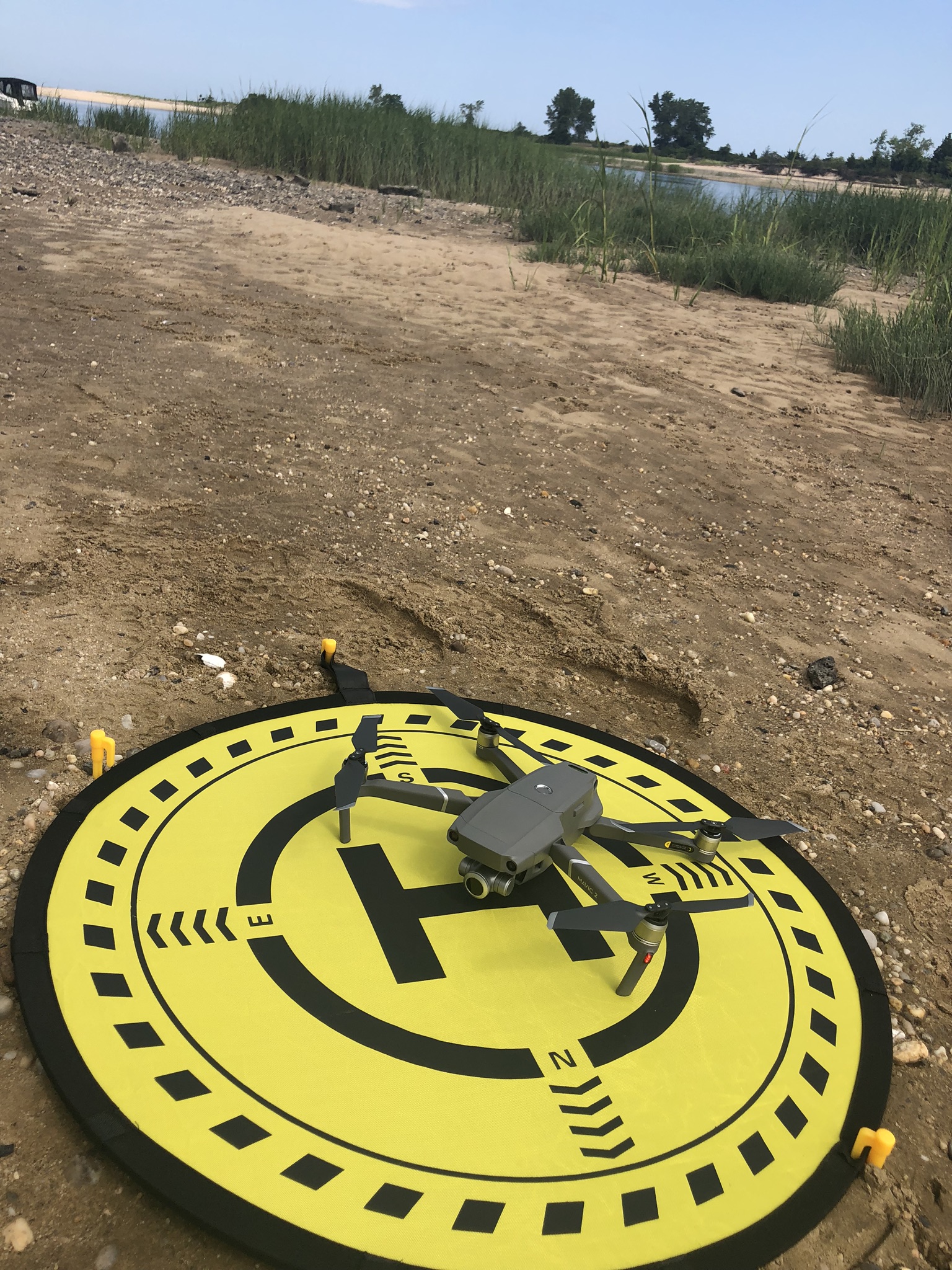
I use the DJI Mavic 2 Zoom, my new Tool of the Trade, I believe these drones are just amazing. If you want to learn more about this drone click this hyper link to read and watch my Mavic 2 drone post.
Watch the latest Video on Finding Backwater Fishing Hot Spots
For Satellite Maps, and Satellite Imagery: I use Google Maps, and Google Earth, they both are free and amazing. In most cases you can get current year updated satellite views of the earth, including all bodies of water.
With Google Earth you also can post or view pictures of the area from users.
When I look at a satellite view of a body of water I look for the same structure and underwater channels I mention above. You can look at the satellite images and target and plan your next trip. By using the earlier tips you can leverage the satellite maps and find great fishing spots all over the world.
For Reviewing Tidal Information : I use (https://tideslegacy.mobilegeographics.com) I use this site to review local tides by typing in my local waterway.
The site provides a good graphic of the tide cycle by time. When fishing I prefer moving water, my favorite is a falling tide. by using the charts I can plan my trip right down to the best departure time so I am positioned at my spot during the optimum time and tide.
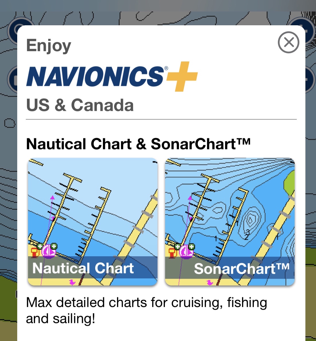
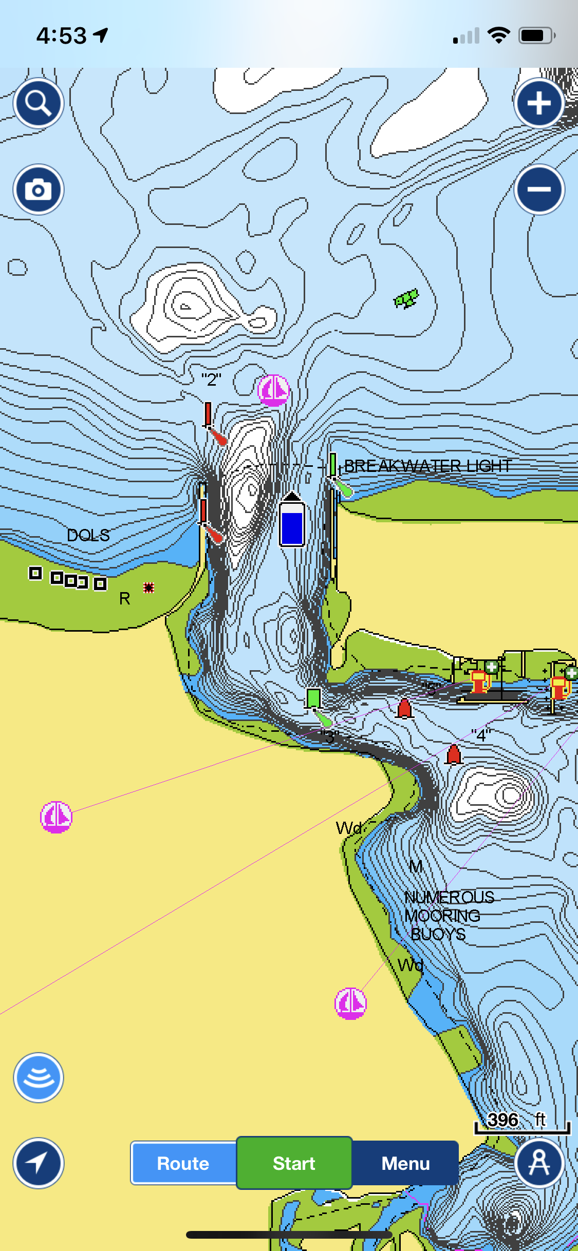
For Nautical Charts, as well as all other nautical information My Go-To App is the Navionics App for my iPhone:
Navionics, Is a Paid App, this year they went from a one time purchase (Of Mapping Locations) to a subscription based pay structure App. The subscription offers constant map updates real time and provides the same great detail.
The App data uses the same data found on the expensive Boat Systems. They both use Navionics cartology software, maps and charts.
Vessel mapping systems and software units can cost thousands of dollars, depending on the brand, display size and system. Just like the Boat versions you can zoom in and out, on any body of water salt or fresh.
You get the same nautical chart detail, found on yachts. The charts include contour, depths as well as locations of obstructions, wrecks, bouys, and a multitude of navigational information.
The GPS plots, and tracks your course, speed, and compass bearing. You can plot way points, pin and mark your favorite areas and spec out and set your routes.
It also comes with an internal tide table, and glossary of navigation aid definitions. You can put the cursor on any object and query on it and the system will describe what it is. VERY COOL and a bargain for the subscription cost.
Using these tools to study and finding new fishing locations is so important. I don’t have to leave the the comfort of my Den where I sit in my LazyBoy Recliner. You can study the images and charts and pick your NEXT FAVORITE FISHING SPOT, all done before you head out on the water.
So The next time you are asked the question;
“Where Did You Catch That Fish?”
Either tell them where you caught it. (NOT!!)
Or
Provide them the link to my blog so they can learn how to research and discover their own fishing spots….FISH ON!!
Oh and if you have been thinking about investing in a Drone yourself I have added a link to the one I use. Just click on the Drone image below to see more information.

This post contains affiliate links